My Sinking Island
BY FARRAH LEONE
The communities of Fire Island, NY host around 4,200 houses that in the summer time are flooded by families, artists, musicians, scientists, seasonal workers, and friends. It’s a laid back lifestyle that includes waving to everyone you see with a smile, never wearing shoes, and embracing a layer of salt on your skin that you can just never wash off. It’s one of the only places where Long Island and NYC residents can escape concrete and enjoy nature.
However, this community is located on federally protected land under the United States National Park Service. The entire area is 26 miles (41.8 kilometers) long and at most just under a mile (1.6 kilometers) in width. It is a barrier island that contains multiple ecosystems from dune communities to salt marshes where research is done and visitors flock to explore. For a marine scientist, this place is my Disneyland. Sand Tiger sharks lie in the marinas, Piping Plovers summer on the dunes, Harbor seals play along the coast, and if you’re lucky a Humpback whale will wave hello to you with their tail. However, this problem does not take place in the ocean, but in the forest.
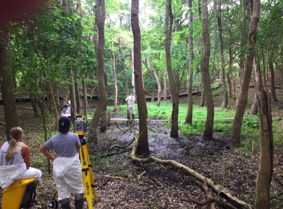
This summer, I completed my master’s degree in Marine Conservation and my final task was to get involved in a research project. I immediately thought back to a project I worked on at Fire Island the summer before. At the time, the department was spread too thin to finish the project and I wanted to give this important research the attention it deserved.
Although it is still in the works, I can tell you a few things about the current study.
1. There is a globally rare American Holly maritime forest called “The Sunken Forest”. This collection of plants is only found in one other park in the entire world, Sandy Hook, NJ.
2. There is an area called the “vadose zone” which is the solid ground beneath our feet and above the freshwater table.
3. The Sunken Forest has been seeing puddles of freshwater pop up around the forest. We know they are freshwater due to wells that collect water data.
a. If you step into one of these puddles, you’ll fall straight through. Sometimes you can fall in up to your waist.
4. These puddles tell us that the freshwater table is being pushed through the surface causing plants to die due to the stress of excess water.
So, why would the forest be turning into a giant puddle?
1. EROSION: The Sunken Forest is at most, .5 miles in width. The entire length of the land was originally 40 acres. Over the past 100 years, 4.5 acres of land has been lost due to erosion. 2 of those have been lost within the past 20 years. The island is thinning, and in the next few hundred years will probably separate the island. The closer an island is to the shore, the less “vadose zone” there is.
2. SEA LEVEL RISE: There are points in the forest where water is breaking the vadose zone at least a meter (~3 feet) above sea level. How does it get there? Sea level rise. When water heats up, it expands. The salt water expanding pushes the groundwater up and the tide closer to the shore.
I always heard about sea level rise impacting foreign tiny islands but now, it is in my backyard. New York and its citizens carry around courage which at times, makes them seem invincible. But we aren’t. If this part of the island is going underwater, how much time is it before the other New York Islands see its impact.
However, the people reading this post and the people working on this team give me hope. With people like you getting involved, getting educated, and spreading information, I believe we can help save this special island. When people realize that climate change evidence is right in front of them, it could cause them to take action too. Imagine thousands of communities being exposed to the reality of climate change in their backyard and taking steps to mitigate their impact on the environment. Even you, reading this article, are making a difference by getting educated.


